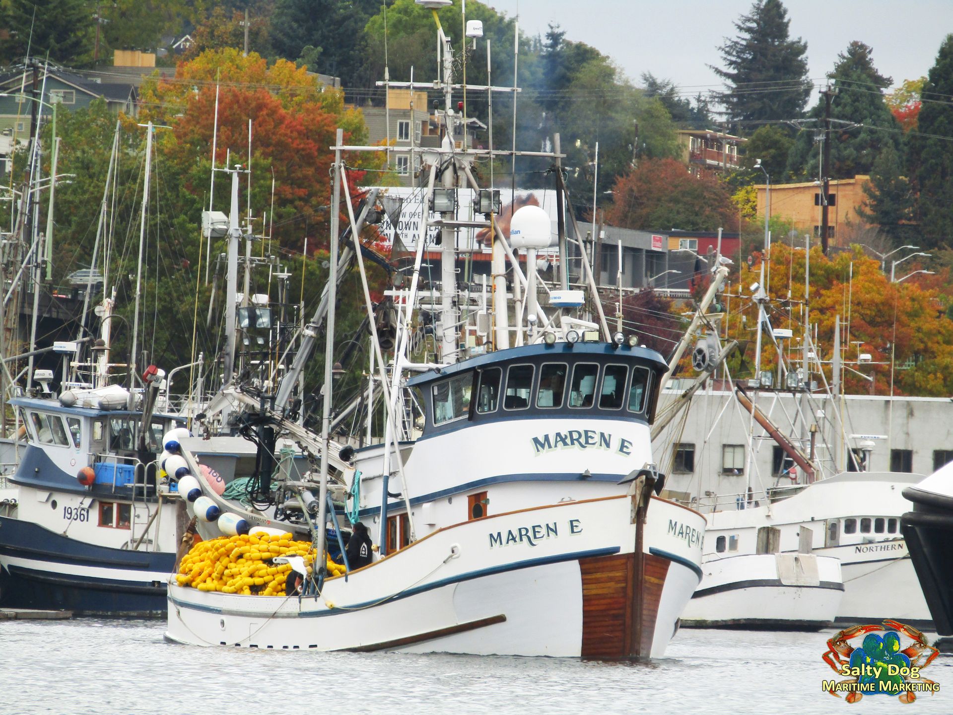
F/V Maren E. Seine Fishing Boat, Fishermen’s Terminal Departing to Locks, Fall Fishing Puget Sound, Commercial Fishing Boat Photography By: Salty Dog Boating News, Salty Dog Maritime Marketing, Commercial Fishing, AK Crab Boat Marine Traffic Underway Source, The Pulse!
Purse Seine Fishing Fleets, homeport at Fishermen’s Terminal in the WA Ship Canal, fall fishing 2017 is in high gear and underway. The Puget Sound is home to a commercial salmon fleet s that include purse seines, gill nets, reef nets and some new types of gear that are currently in the experimental stage. Non-treaty commercial fishing rules changes and this year’s fall fishing schedule of openings are available Washington Department of Fish and Wildlife.
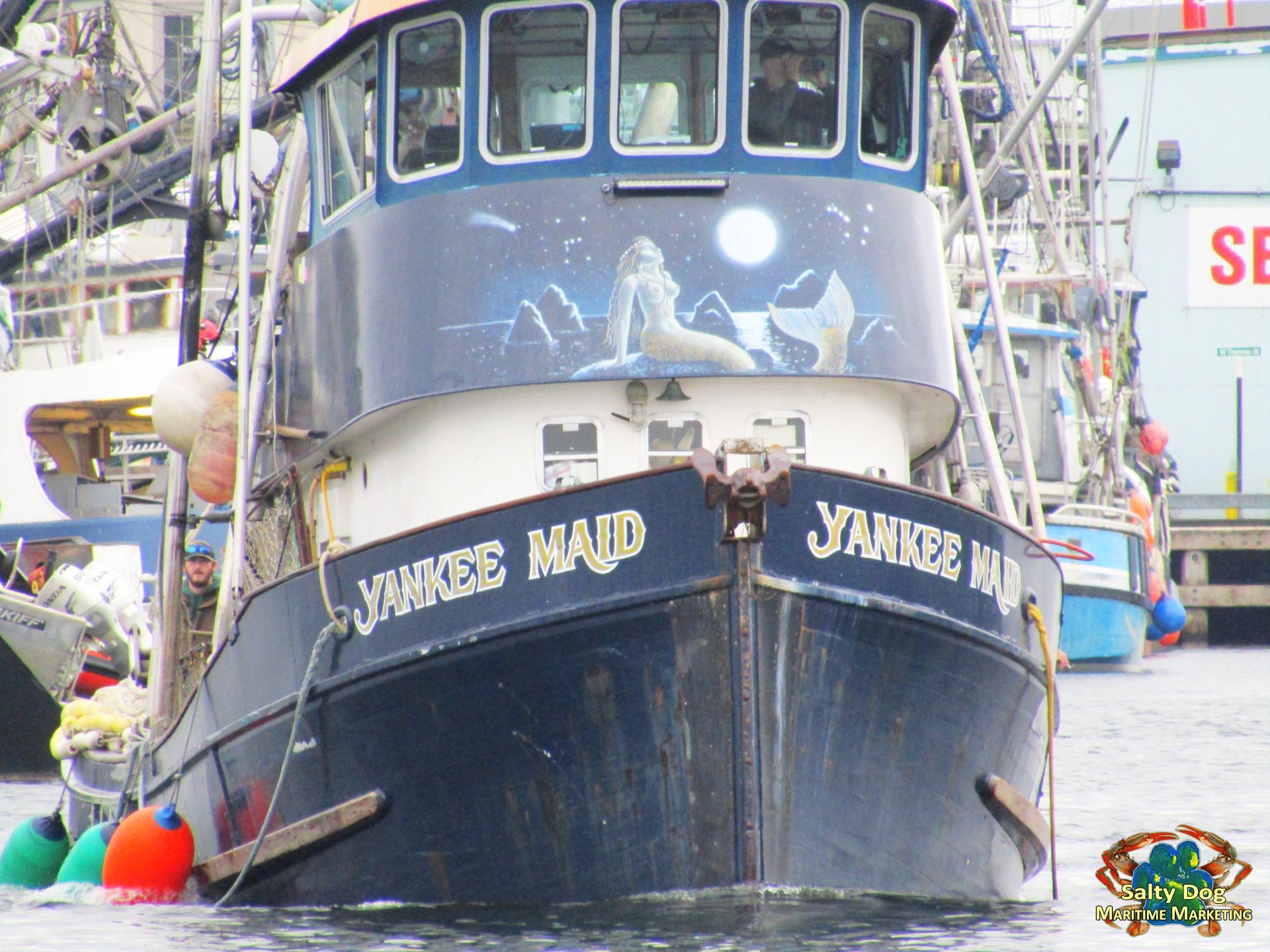
F/V Yankee Maid, Seine Fishing Boat Departing Fishermen’s Terminal WA Ship Canal going for a Drop at Ballard Locks to Puget Sound for WA Fall Fishing Underway PNW, Commercial Fishing Boat Photography By: Salty Dog Boating News, Salty Dog Maritime Marketing, Commercial Fishing, AK Crab Boat Marine Traffic Underway Source
Washington Department of Fish and Wildlife has negotiated new salmon seasons through the North of Falcon/Pacific Fishery Management Council process for 2017. Per late summer 2017 reported: Similar to recent pink years they are planned a limited participation fishery targeting pink salmon in Area 10. Special note, the South Sound pink forecast is down from recent years with a 2017 forecast of 523,772. Unlike recent years, there was no limited participation coho fishery planned in Area 8A due to extremely low forecasts of Skagit and Stillaguamish coho.
Commercial Seine Fishing Boat Photography By: Salty Dog Boating News, Salty Dog Maritime Marketing, Commercial Fishing, AK Crab Boat Marine Traffic Underway Source, The Pulse! Visit: www.saltydogmaritimemarketing.com – Also contact us at: boating@saltydogfishingnews.com We look forward to hearing from ya’ll soon!
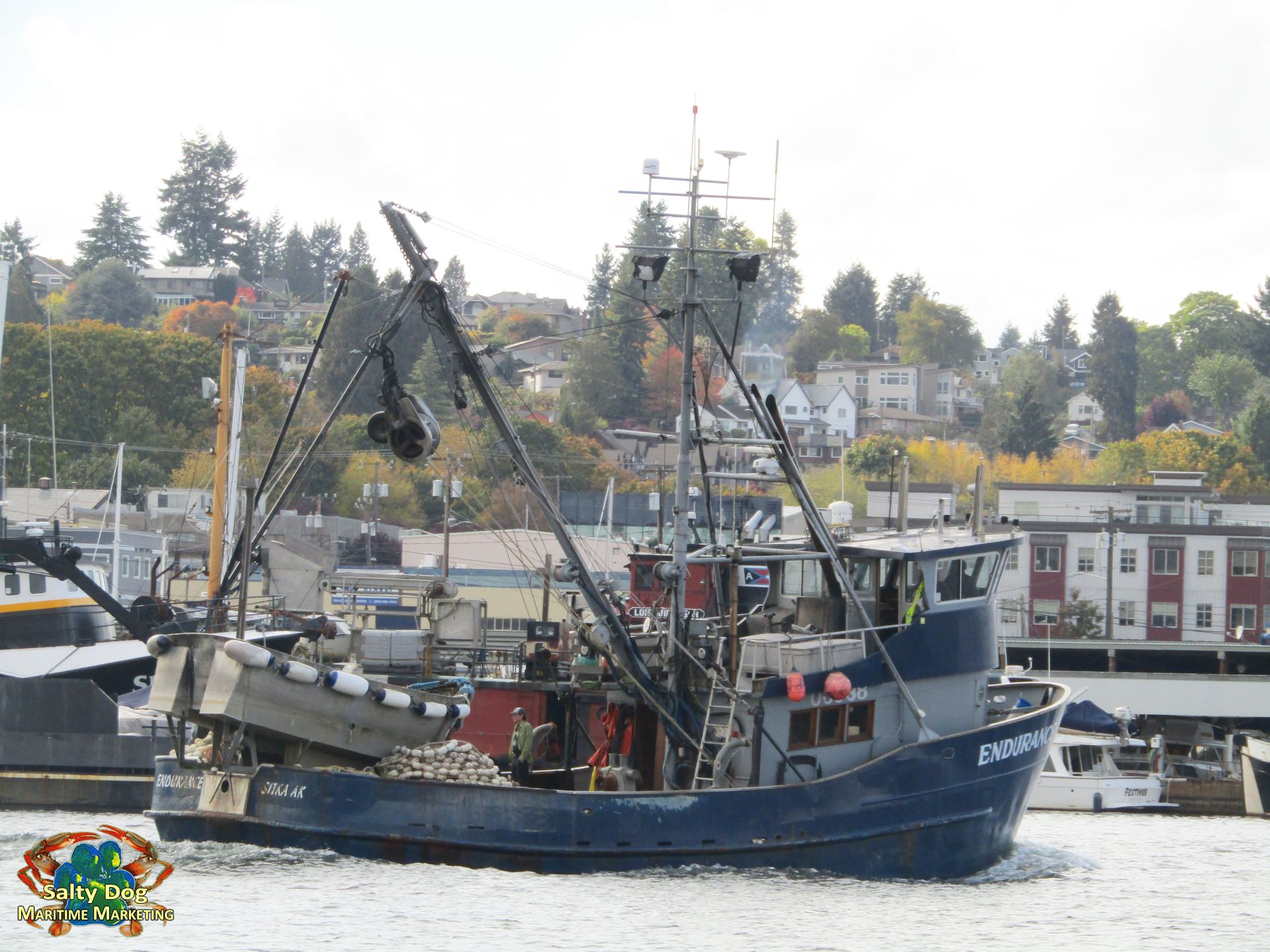
F/V Endurance, Seine Salmon Fall Fishing, Passing Fishermen’s Terminal to Ballard Locks near Pacific Fishermen Shipyard in Salmon Bay, Fall Fishing to Puget Sound, Fall Salmon Fishing PNW, Commercial Fishing Boat Photography By: Salty Dog Boating News, Salty Dog Maritime Marketing, Commercial Fishing, AK Crab Boat Marine Traffic Underway Source, The Pulse! Fish On!
PURSE SEINE GEAR REQUIREMENTS: Fall Fishing 2017: FYI – Note: A purse seine considered to no longer be fishing once both ends of the net are attached to the primary vessel. Ø Webbing Minimum Twine Size: · 210/30d nylon. · 12 thread cotton. · Equivalent diameter in any other material. Ø Maximum Net Length: · 1800 feet along the cork line while wet. · Purse seine and lead combined may not exceed 2200 feet. Ø Web of purse seine and lead may not: · Be lashed together to form one continuous piece of webbed gear. · Contain mesh of a size less than 3 ½ inches.
Bunt Dimensions / Restrictions: · Not more than 10 fathoms long. · Mesh size not less than 3½ inches.
5 Inch Strip Requirement: · Required in all areas, except not applicable during sockeye and pink salmon management. · Minimum mesh size of 5 inch stretch mesh. · Must be located in top 100 meshes of net (nearest the corkline) within 75 fathoms of bunt, but not in the bunt.
Cork Line Bird Openings: · At least 4 sections required, each at least 12 inches in length (no corks or floats attached). · Location of bird openings: ◦ One must be in bunt within 5 fathoms of seine net. ◦ Other three must be at least 20 fathoms apart and within 75 fathoms of the bunt.
SALMON MINIMUM SIZE LIMITS: Ø Chinook 28 inches Ø coho 16 inches Ø other salmon no minimum size
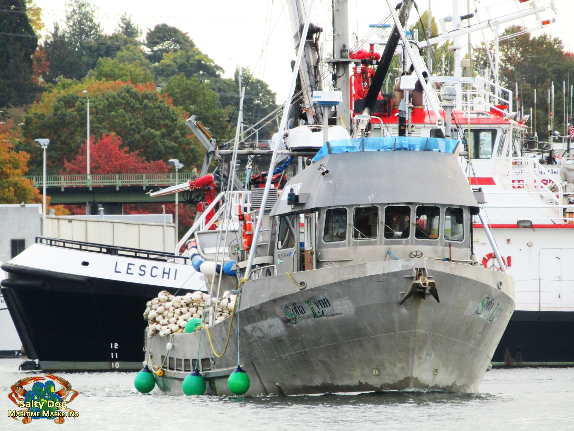
F/V Sofia Lynn, Seine Boat Fall Fishing Puget Sound, Salmon Fishing Greater Seattle Area Seine Salmon Boats Gone Fall Fishing, Commercial Fishing Boat Photography By: Salty Dog Boating News, Salty Dog Maritime Marketing, Commercial Fishing, AK Crab Boat Marine Traffic Underway Source, The Pulse!
Purse seine: a fishing gear consisting of a lead line, cork line, auxiliary lines, purse line, and purse rings and mesh webbing fashioned and used to encircle fish and prevent their escape under the bottom of the net by means of the purse line so that it forms a closed bag.
Beach seine: a fishing gear consisting of a lead line, cork line, auxiliary lines and a mesh net webbing fashioned in such a manner that it can be used to encircle fish in waters adjacent to any beach, with the catch landed directly on the beach
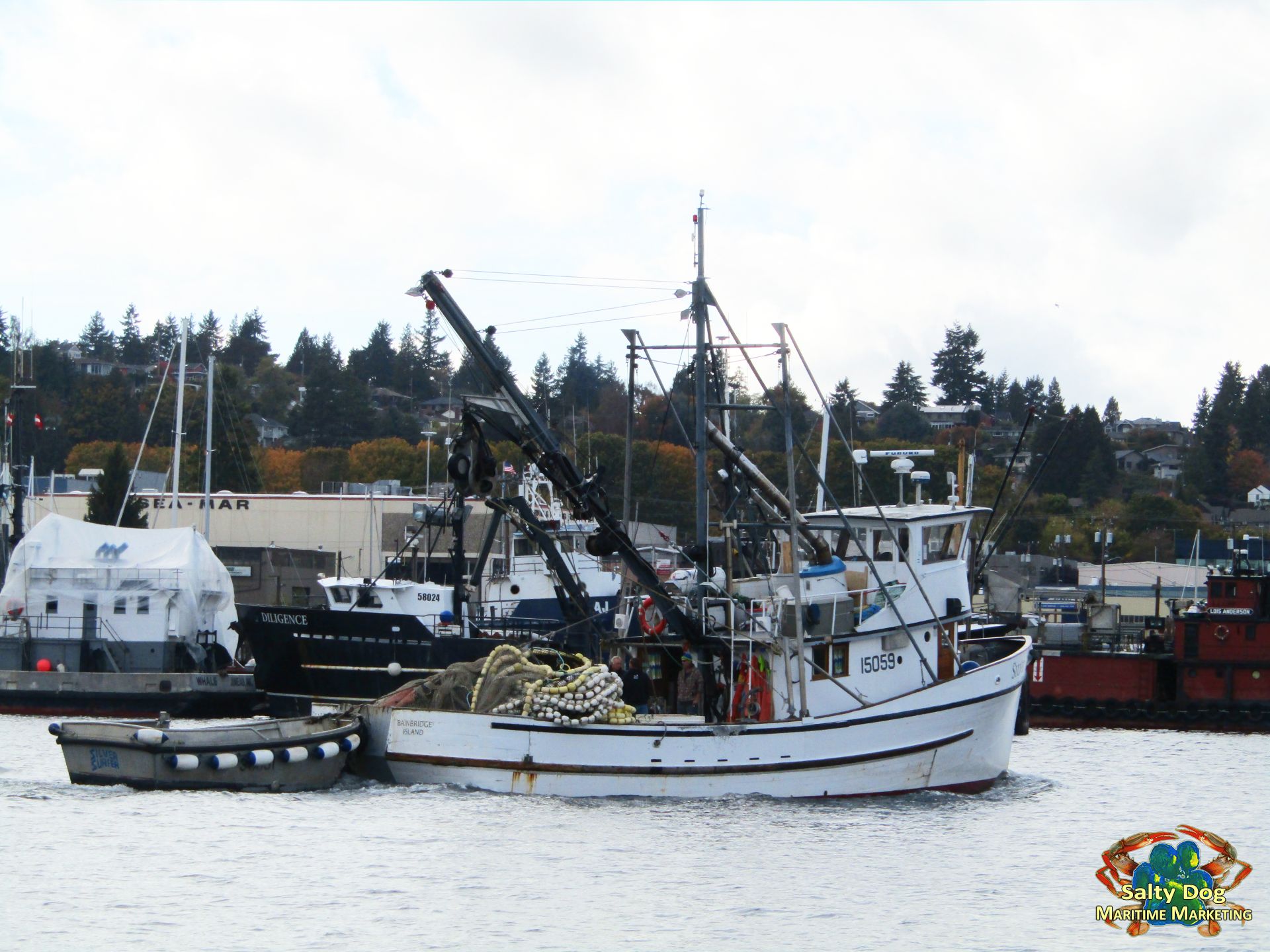
F/V Gjoa, Seine Salmon Fishing Puget Sound, Fall Fishing, Chain Cheater Bar Crew on Deck, Fall Salmon Fishing, Commercial Fishing Boat Photography By: Salty Dog Boating News, Salty Dog Maritime Marketing, Commercial Fishing, AK Crab Boat Marine Traffic Underway Source
Purse seine mesh size: distance between the inside of one knot to the outside of the opposite vertical knot of one mesh. Minimum purse seine mesh size is met if a wedge of legal size can be passed without undue force through the mesh while wet.
Drift Gillnet: a gillnet of single web construction, not anchored, tied, staked, placed, or weighted in such a manner that it cannot drift
Reef net: an open bunt square or rectangular section of mesh netting, suspended between two anchored boats, designed to impound salmon passing over the net when the net is raised to the surface. Leads must be floating at all times, except under stress of tidal conditions, and shall not be fixed to any pilings, nor shall the lead be constructed of any kind of mesh webbing. No principle of a fyke net or fish trap may be employed.
Set net: a gillnet which is anchored, tied, staked, laid in part on shore, or whose lead line is so heavily weighted that it cannot drift.
Time: all references to time in regulations shall be local time; (summer and fall) local time is Pacific Daylight if prior to first Sunday in November, and Pacific Standard Time during the first Sunday in November and thereafter.
AREA 6 shall include those waters of Puget Sound easterly of a line projected from the Angeles Point Monument to the William Head light on Vancouver Island, northerly of a line projected from the Dungeness Spit light to the Partridge Point light, westerly of a line projected from the Partridge Point light to the Smith Island light, and southerly of a line projected from the Smith Island light to vessel traffic lane buoy “R” to the Trial Island light.
AREA 6A shall include those waters of Puget Sound easterly of a line projected from the Partridge Point light to the Smith Island light to the most northeasterly of the Lawson Reef lighted buoys (RB 1 Qk Fl Bell) to Northwest Island to the Initiative 77 marker on Fidalgo Island and westerly of a line projected from Reservation Head on Fidalgo Island to West Point on Whidbey Island.
AREA 6B shall include those waters of Puget Sound southerly of a line projected from the Dungeness Spit light to the Partridge Point light, westerly of a line projected from the Partridge Point light to the Point Wilson light and easterly of a line projected 155 degrees true from Dungeness Spit light to Kulakala Point.
AREA 6C shall include those waters of Puget Sound easterly of a line projected true north from Low Point and westerly of a line projected from the Angeles Point Monument to the William Head light on Vancouver Island.
AREA 6D shall include those waters of Puget Sound westerly of a line projected 155 degrees true from Dungeness Spit light to Kulakala Point.
AREA 7 shall include those waters of Puget Sound southerly of a line projected true east-west through Sandy Point Light No. 2 (48 degrees, 47.2 minutes north latitude, 122 degrees, 42.7 minutes west longitude, as per U.S. Coast Guard Light List No. 19880), northerly of a line projected from the Trial Island light to vessel traffic lane buoy “R” to the Smith Island light to the most northeasterly of the Lawson Reef lighted buoys (RB 1 Qk Fl Bell) to Northwest Island to the Initiative 77 marker on Fidalgo Island, and westerly of a line projected from Sandy Point Light No. 2 to Point Migley, thence along the eastern shoreline of Lummi Island to Carter Point, thence to the most northerly tip of Vendovi Island, thence to Clark Point on Guemes Island following the shoreline to Southeast Point on Guemes Island, thence to March Point on Fidalgo Island, excluding those waters of East Sound northerly of a line projected due west from Rosario Point on Orcas Island.
AREA 7A shall include those waters of Puget Sound northerly of a line projected true east-west through Sandy Point Light No. 2 (48 degrees, 47.2 minutes north latitude, 122 degrees, 42.7 minutes west longitude, as per U.S. Coast Guard Light List No. 19880), terminating on the west at the international boundary and on the east at the landfall on Sandy Point.
AREA 7B shall include those waters of Puget Sound westerly of a line projected 154 degrees true from Sandy Point Light No. 2 (48 degrees, 47.2 minutes north latitude, 122 degrees, 42.7 minutes west longitude, as per U.S. Coast Guard Light List No. 19880) to the landfall on Gooseberry Point, easterly of a line projected from Sandy Point Light No. 2 to Point Migley, thence along the eastern shoreline of Lummi Island to Carter Point, thence to the most northerly tip of Vendovi Island, thence to Clark Point on Guemes Island following the shoreline to Southeast Point on Guemes Island, thence to March Point on Fidalgo Island, northerly of the Burlington Northern railroad bridges at the north entrances to Swinomish Channel, westerly of a line projected from William Point light on Samish Island 28 degrees true to Whiskey Rock on the north shore of Samish Bay, and westerly of the Whatcom Creek mouth, defined as a line projected approximately 14 degrees true from the flashing light at the southwest end of the Port of Bellingham North Terminal to the southernmost point of the dike surrounding the Georgia Pacific treatment pond.
AREA 7C shall include those waters of Puget Sound easterly of a line projected from William Point light on Samish Island 28 degrees true to Whiskey Rock on the north shore of Samish Bay.
AREA 7D shall include those waters of Puget Sound easterly of a line projected 154 degrees true from Sandy Point Light No. 2 (48 degrees, 47.2 minutes north latitude, 122 degrees, 42.7 minutes west longitude, as per U.S. Coast Guard Light List No. 19880) to the landfall on Gooseberry Point, and south of a line projected true east from Sandy Point Light No. 2 to the landfall on Sandy Point. n Samish Island 28 degrees true to Whiskey Rock on the north shore of Samish Bay.
AREA 7E shall include those waters of Puget Sound within East Sound northerly of a line projected due west from Rosario Point on Orcas Island.
RELEASE OF INCIDENTALLY CAUGHT FISH: Retention of the following salmon taken with purse seine gear is prohibited: Ø Chinook at all times in Areas 7, 7A, 8, 8A, 8D, 10, 11, 12, 12B, 12C; and after Oct 20 in 7B. Ø Coho at all times in Areas 7, 7A, 10, 11; and prior to Sept 1 in Area 7B. Ø Chum at all times in Areas 8, 8A; during Area 10 pink directed fisheries; and prior to Oct 10 in Areas 7 and 7A.
For More: Purse Seine Fishing Info: Visit: http://wdfw.wa.gov/publications/01920/wdfw01920.pdf
Puget Sound Commercial Salmon Regulations and Information: http://wdfw.wa.gov/fishing/commercial/salmon/
F/V Silver Wave, Seine Fishing Boat, Fall Fishing Puget Sound, Departed Fishermen’s Terminal, to Ballard Locks for a Drop to Puget Sound for Fall Salmon Fishing, Geared Up, Commercial Fishing Boat Photography By: Salty Dog Boating News, Salty Dog Maritime Marketing, Commercial Fishing, AK Crab Boat Marine Traffic Underway Source, Eat Fresh – Buy Wild!
Commercial Seine Fishing Boat Photography By: Salty Dog Boating News, Salty Dog Maritime Marketing, Commercial Fishing, AK Crab Boat Marine Traffic Underway Source, The Pulse! Visit: www.saltydogmaritimemarketing.com – We look forward to hearing from ya’ll soon!
EAT FRESH – BUY WILD!
God Bless Our Fishermen, Fisherwomen & Their Families on land at at sea!